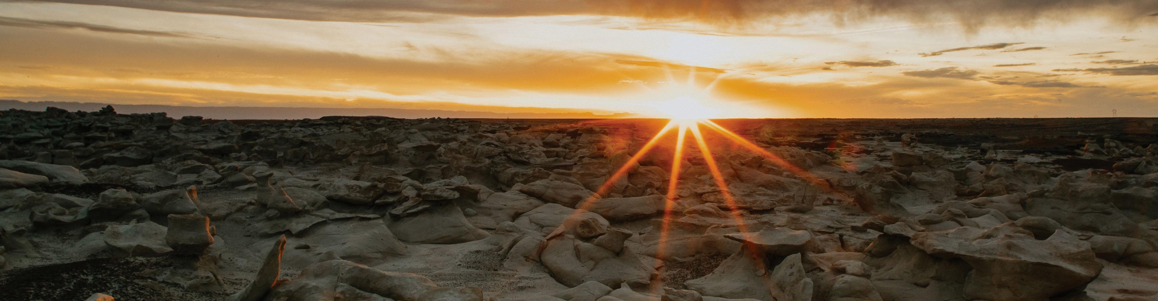
With a variety of terrains available, Farmington offers scenic and challenging mountain biking adventures year-round. Whether you’re an experienced enthusiast or a newbie, our trails offer something for everyone.
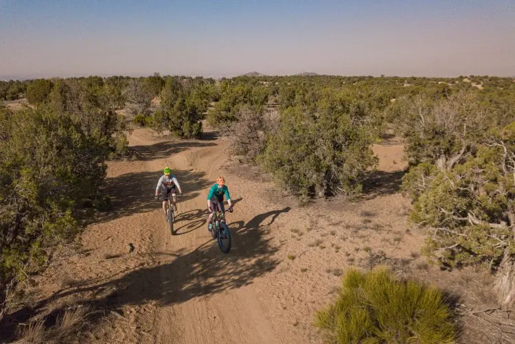
Mountain biking trails are abundant throughout Farmington and offer a unique opportunity to experience the beauty and scenery of the high desert. More than 30 miles of trails can be accessed within minutes from Main Street, delighting mountain bikers that live in, or visit, Farmington. Even more trails, bike parks, and recreation areas are currently being developed. Check back often for updates and links to the most accurate resources.
Farmington Mountain Biking Trails
Anasazi Trail
Located in the northern region of Pinon Hills Blvd., adjacent to College Blvd, the Anasazi Loop offers an exciting hiking experience on the north side of Farmington. The most convenient entry point to this trail is through the Hood Mesa Trail parking lot. This trail is a local favorite, offering a quick, picturesque, and easily navigable loop for all to enjoy. The trail is comprised of a mix of hardpack soil and sand, adding to its unique charm. Tiny hill climbs are scattered along the trail, interspersed with a few dry wash sections, giving it a varied and interesting terrain. The Anasazi Loop is also known for its magnificent views, which can be appreciated from multiple vantage points along the trail. The trail spans a manageable distance of 2.8 miles, catering to both beginners and intermediate cyclists. It's fast-paced, short loop can be seamlessly integrated into longer trails like Kinsey, allowing you to extend your adventure.
- Distance: 2.8 miles Easy to Intermediate
- A fast short loop that can be added on to longer trails like Kinsey to extend your ride time.
- Trail map at mtbproject.com and All Trails
Pinon Mesa Loop
The Pinon Mesa Loop is an engaging 16-mile trail that navigates through the badlands, up to the summit of Pinion Mesa, and descends through a beautiful scape of Junipers. The ascent can be challenging due to the trail's softness, which continually tests your momentum. Upon reaching the summit, a picturesque panorama of Shiprock and Hogback awaits. The trail concludes with an exhilarating downhill section. To find the trailhead, locate the intersection of Pinion Hills and Hwy 170, and travel north on Hwy 170 for approximately 0.7 miles. A distinctive, solitary Cottonwood tree in a small parking lot on the west side of the road marks the trailhead, which begins at the green gate.
- Distance: 16 miles Intermediate trail
- Popular scenic trail with varied terrain
- Trail map is available on mtbproject.com
Road Apple Rally
The Road Apple Rally, one of the longest-standing mountain bike (MTB) races in the United States, is a widely recognized event among professional riders. The Road Apple Rally trail starts at College Blvd, north of Pinon Hills Blvd, either at Lions Wilderness Park or Hood Mesa Trail. If you start from the Lions Wilderness Park, you'll embark on a 1.5-mile pavement ride along College Blvd until it intersects with Hood Mesa Trail at a four-way junction. Here, you'll transition onto a dirt road. Make sure to keep an eye out for the distinctive Road Apple Rally carsonite posts as you navigate the dirt trail. This trail is a local favorite, renowned for its feature in the annual Road Apple Rally MTB race, which takes place every first Saturday in October. Boasting a distance of 30.1 miles, this intermediate-level ride offers a swift and flowing journey through diverse terrains. The route meanders through rolling single tracks and roads enveloped by pinon and juniper trees, punctuated by sandstone formations and badland landscapes.
- Distance: 30.1 miles Intermediate
- This fast-flowing ride features rolling singletrack plus roads through scenic landscapes
- Trail map at farmingtonnm.gov
Kinsey Trail
To reach the trailhead, take Foothills Drive north until it intersects Colibri Place.
- Distance: 3.7 miles Intermediate
- A sandy yet firm trail with rolling dips and turns.
- Trail map at mtbproject.com
Foothills Loop
Access the trail at Colibri Place and Road 3800.
- Distance: 9 miles Intermediate
- This loop takes you along a ridgeline for a beautiful view and fast-paced ride.
- Trailmap at mtbproject.com
San Juan College Bike Park
The San Juan College Bike Park offers a wide variety of hiking and biking terrains through 160 acres of open space designated non-motorized. Park entrance is located just south of Mesa Verde Elementary School off of College Blvd., north of 30th Street. Another access point is at the southeast corner of Butler and Sunrise. Also, ¼ mile south of that intersection on the east side of Butler.
- The Barker Loop Trail is .75 miles in and can be ridden in either direction. This is a Green Trail, with 105 feet of gain in elevation. The trail terrain is firm and stable.
- The Scenic Loop Trail is ridden in a clockwise direction. The total distance of this Green Trail is 1.10 miles with an elevation gain of 105 feet. The trail terrain is firm and stable. Flat scenic walk on top of the mesa. This trail navigates users past the historic gravesite and to the top of the mesa.
- The Fence Line Trail is 1.57 miles and is ridden clockwise with 178 feet of gain in elevation. This is a Blue Trail, rated more difficult than the Green Trails. The terrain is mostly stable with some variability. The trail features tight and twisty single track with punchy climbs. This singletrack is for more experienced trail users.
- Trail 1896 is 1.30 miles in distance and can be ridden in both directions with 221 feet of gain in elevation. This is a Blue Trail, rated more difficult than the Green Trail. The terrain is mostly stable with some variability. The trail features gradual single track with a series of switchbacks. This trail is used to connect Fenceline, Scenic, and Barker trails.
East Glade Skills Park
To access the park, use the east Glade Run Parking Lot located 1/8 of a mile north of Colibri Place on Calle Norte Trail in Farmington.
The East Glade Skills Park bike park offers features for all levels of riders. The park offers a Strider track for little kids with a boardwalk roller coaster and balance beam. The three trails that are in the park start from an elevated block where a rider can roll into their choice of green (easy), blue (moderate), or black (difficult) bike park-style trail without the need of peddling. After the roll-in, there are tabletops and large berms on the green line. The blue line begins with a drop that continues into a hip, then a few tabletops, into a berm to berm, a few more tabletops, and finishes with a large double berm. For the final bike park trail, the rider can drop off two feet from the start blocks into a huge boardwalk hip, a huge boardwalk step-up after a berm, a huge boardwalk tabletop, and finishes with another boardwalk tabletop. All of the trails share a return trail back up to the top. It is set up in a way that a rider can easily progress through the different difficulties of trails that flow through the trees.
Recommended Mountain Biking Resources
- 505 Cycles
- SJC Outdoor Equipment Rental Center
- Trail apps and websites locals love: mtbproject.com and trailforks.com
- Farmington Recreation Trail Map available at the Farmington Museum & Visitor Center
- Download the Farmington Recreation Trails Map and Farmington Recreation Trails Map 2
- Farmington Area Single Track - F.A.S.T.